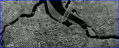
This image cuts across the heart of Washington, D.C. extending from Arlington, Virginia near the Potomac River to the Robert F. Kennedy Stadium on the Anacostia River. One should note that the top of the image is south. In 1791, George Washington selected Pierre Charles L'Enfant to establish the basic plan for the District of Columbia. L'Enfant developed a large east-west open space, later to be identified as the Mall with the Capital situated at the east end. A second, smaller north-south space was extended off the Mall with the White House located at the north end of this space. L'Enfant's plan used a grid street pattern with broad diagonal avenues and squares and circles superimposed on the grid. This street layout reflected some of the experimental city planning occurring in Europe during this period. This image highlights this street pattern. Also, the image clearly shows the various government buildings and public structures, especially along the Mall.
The choppy appearance of the image is partially due to the complexity of the urban surface with numerous structures providing sharp vertical changes. Responses which radar receives from such surface conditions create an image, which appears to have very bright surface covers followed quickly by very dark surfaces. The Washington Monument can be detected by the long, dark line running north of the monument. This is not the shadow of the monument which might be observed if an optical remote sensing device was being used. The side angle radar platform was to the south of the monument when the image was recorded and the radar responses hitting the south side of the monument were not able to detect the land on the north side creating a void area in the shape of the monument. Thus, the dark areas on the image are void areas where the radar does not receive any response pulse due to structures blocking the pulse flow.
This image as well as the images below was acquired by the Sandia National Laboratories in Albuquerque, New Mexico. A Twin Otter aircraft was employed with a Synthetic Aperture Radar (SAR) operating in the Ku-Band. The Laboratories offer state-of-the-art capability in environmental monitoring, earth-resource mapping, and military applications to obtain high-resolution SAR imagery. Work is generally done in the Ku-Band (14-16GHz), X-band (7.5-10.2 Ghz), K-Band (32.6-37.0 Ghz) and the VHF/UHF bands (125 to 950 MHz).
The Smithsonian, a huge museum, educational, and research complex, was established in 1846 based on the inspiration of James Smithson, an Englishman, who bequeathed to the country over half a million dollars to develop "an Establishment for the increase and diffusion of knowledge among men." The image shows most of the Smithsonian complex and the Mall. Again, the top of the image is south. The two major east-west roads are Constitution Avenue (bottom) and Independence Avenue (top). Starting from the right along Constitution Avenue one can see the National Museum of American History, National Museum of Natural History, and National Gallery of Art - West Building. Starting along Independence Avenue one encounters the Smithsonian Institution (opposite the National Museum of Natural History), the Hirshhorn Museum and Sculpture Garden (the circular structure, and the National Air-Space Museum which is situated directly across Independence Avenue from NASA Headquarters. It is possible to identify and count every tree along the Mall from this image.
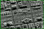
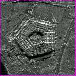
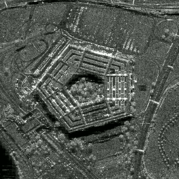
The Pentagon is the headquarters for the U.S. Department of Defense and the world's largest office building. This five-sided structure has five stories plus two basements and covers 29 acres (10 hectares) of land surface. The open court is 5 acres (2-hectares) in size and the image makes it possible to identify the tree-covered areas versus the open areas. Nearly 70 acres (30 hectares) are dedicated for parking and the parking lots can accommodate 10,000 cars. An examination of the image shows that less than half of the parking spaces are being used. It is 11:30 at night and most of the regular daytime staff has gone home.
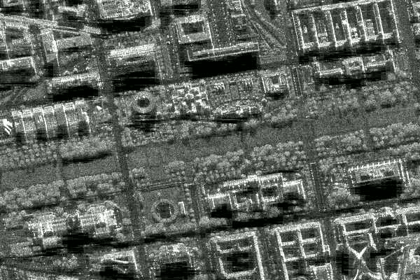
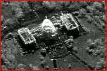
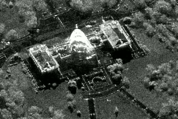
This structure is one of the most important buildings in the United States. It is where the nation's laws are made. The oblique view of the image creates the illusion of a three-dimensional picture. Also, the building appears to be outlined by rows of lights but the bright features on the image are due to the complexity of the building's surface and how the radar pulse is bouncing off the structure.
Scenes were acquired at 11:30 p.m., December 12, 1995 under heavy cloud conditions.
Check the following home page for additional high-resolution aircraft imagery.
http://www.sandia.gov/RADAR/sar.html
>Back