Brazil - Manaus
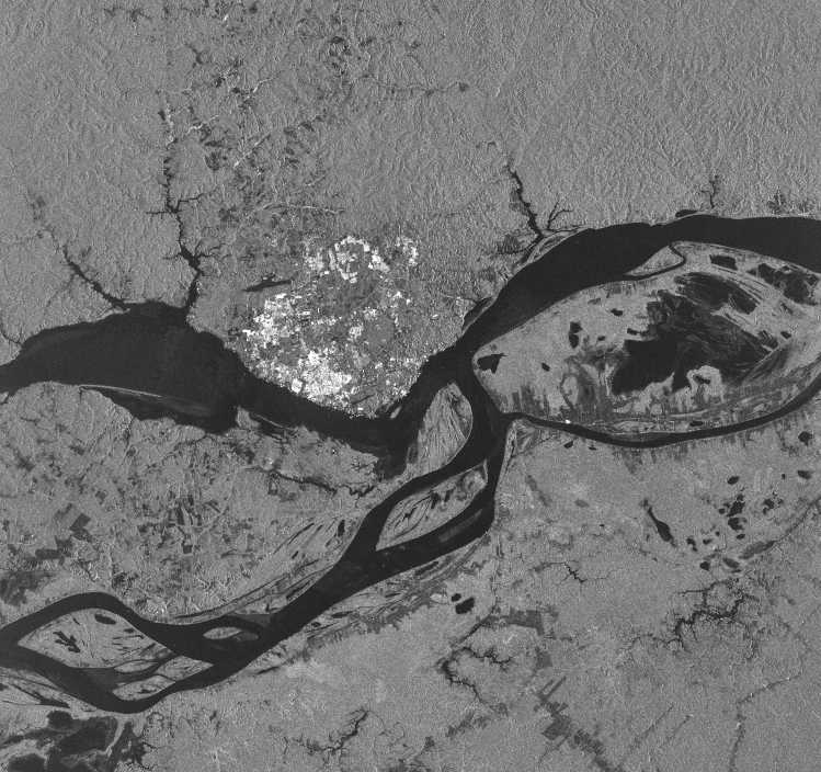
This image covers the area where the Rio Negro and the Rio Solimoes join to form the Amazon. Most of the region is tropical rainforest centered in the middle of the Amazon Basin. The large bright surface corresponds to Manaus, the major commercial center within the Basin. The city, the capitol of the Brazilian state of Amazonas, is situated on the Rio Negro about 10 miles (16km) from where the river enters into the Amazon. With the city being only 120 feet (36.5m) above sea level and the river being so large, oceangoing vessels can easily reach the city with its population of one million people. The distance from the Atlantic Ocean is 1,000 miles (1,600 km). In fact, ocean liners can steam 2,300 miles (3680 km) up the Amazon to reach Peru's "Atlantic seaport", Iquitos, which is only 300 feet (91.4m) above sea level. In comparison oceangoing ships on the Mississippi can only reach Baton Rouge, 170 miles (272 km) from the mouth of the river. Spreading north of Manaus and situated on the southside of the Rio Negro one can detect where the tropical rainforest has been cut down to make way for agricultural fields. These areas are generally in a dark gray. In the early 1970s Brazil started a very ambitious use of radar in a tropical forest-land cover inventory called RADAM (Radar Amazon). Airborne radar imagery which could cut through the heavy cloud and tree cover of the rainforest was acquired for 1.9-million square miles (nearly 5-million square kilometers) for the purpose of mapping the resouces within the Amazon Basin. However, this inventory and its maps made it possible for greater settlement and deforestation within the Basin.
Amazonian rivers and streams are generally in an advanced state of leaching creating low mineral content. Mainly two types of water dominate the river system. Both are characterized by purity and transparency but differ in color and other respects. From the Guayana and Brazilian highlands bleached sands create rivers with dark brown water. Such rivers possess poorly defined, sloping banks which are frequently covered by inundated forest. Litter from this vegetation enters the riverbeds where the decaying process consumes oxygen and releases carbonic and humic acids. These oxygen-deprived, acidic environments are often referred to as starvation rivers. The Rio Negro and most of its right bank tributaries form the black water rivers.
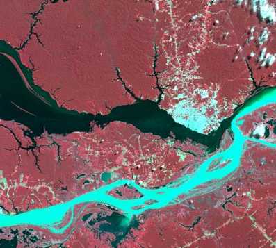
From the slopes of the Andes heavy soluble and suspended minerals and soil particles cascade down to the lowlands to form what are called the white water rivers. This white water has low transparency and contains only a slight amount of alkaline. Although the headwaters of the Andes account for only 12 percent of the water in the Basin, they provide 86 percent of the dissolved salts and 82 percent of the suspended solids discharged by the Amazon. The Rio Solimoes is a white water river. The difference between the white and black water rivers is not easy to detect in the SAR image but the false color spectral image, a Landsat MSS image taken on July 12, 1987, clearly shows the difference between the Rio Negro and the Rio Solimoes.
Scene acquired on October 19, 1995.
To obtain other images covering the Amazon go to
http://southport.jpl.nasa.gov/amazon/imagebrower/
>Back