METR 360
Fall,
2016
Exam 2
Directions:
Answer all parts of all questions in the blue books or write a
text file
which you may e-mail to Jerome.Blechman@oneonta.edu.
For
calculations, show all work. You may use
any source, including your notes, any textbook or the Internet. You may NOT talk during the exam, except to
me. Raise your hand if you have a
question.
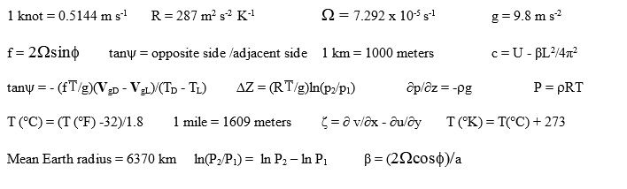
The following
information may (or may not) be
useful:
1. For this
question, refer to the 12Z 500 hPa map.
a.
( 10%) You have a greyscale paper copy of the map.
Draw height contours using the standard
contour interval, assuming perfectly geostrophic flow. Be sure you have
the
correct heights. Label them
properly.
b.
( 4%) Short answer: The flow in the
northern half of the central U.S. is most accurately described as
A.
Zonal B. East to west C. Cold advection D. Meridional
c.
( 4%) Find the one station with a wind that is going in a
direction that
is exactly opposite to what the height contours require.
Circle it on the paper map and write the three-letter identifier
in your blue book or text file.
d. ( 4%) On
your paper map from part a, mark a trough and a
ridge. Write the words on the map in the
proper places for those labels.
e.
( 6%) Based on your answers to part d, where would you expect to find
the
surface High and Low? Write the labels
“High” and “Low” on the map.
f.
( 6%) What would you expect of the
movement for these surface
features?
g.
( 6%) The part of the map around New York State is expanded here. A fictional
station
identified NYX has been added. What is
the sign of the relative vorticity at NYX?
What is the sign of the absolute
vorticity at NYX? Do not show any
calculations.
h.
(6%) Also at NYX, what weather would be expected from the vertical
motion that
would result solely from the absolute vorticity from part g? Briefly explain.
2. This question is
about the MOS guidance shown
below:
KWOW
GFS MOS GUIDANCE 1200
UTC
DT
/OCT
12/OCT 13
/OCT 14
/OCT 15
HR 18
21 00 03 06 09 12 15 18 21 00 03 06 09 12 15 18 21 00 06 12
N/X
49
55
36
53
34
TMP 59 60
56 53 51 51 51 52 53 51 46 43 40 38 37 44 49 50 45 38 36
DPT 42
42 43 45 46 47 47 48 45 43 41 38 36 34 33 34 32 29 28 30 30
CLD CL CL CL BK CL SC OV OV OV OV
CL CL CL FW FW CL CL CL
CL CL CL
WDR 19
18 18 18 18 18 19 21 28 31 32 33 33 33 33 01 35 35 02 10 15
WSP 08
09 08 08 07 08 08 07 09 10 08 07 05 06 06 07 07 05 04 02 04
P06
1 0
6
91 13
1
10 2
2 2 0
P12
7
91
10
5
5
Q06
0 0
0
2 0
0
0 0
0
0 0
Q12
0
2
0
0
0
T06
0/ 0 0/ 0 3/
1
5/ 3 0/ 0 0/
0
3/ 0 1/ 0 1/
0
0/ 0
T12
3/ 0 9/
4 0/ 8 6/ 1
1/ 0
POZ 0 0
0 0 1
0 1 1
0 0 0
0 0 0
0 0 0
0 0 1 0
POS
0 0 0
0 0 0
0 0 0
0 0 0
0 0 0
0 0 0 4
16 0
TYP
R R R
R R R R R R R R R R R R R R R R R R
SNW
0
0 0
CIG
8 8 8
8 8 8
4 2 2
4 8 8
8 8 8
8 8 8
8 8 8
VIS
7 7 7
7 7 7
7 4 5
7 7 7
7 7 7
7 7 7
7 7 7
OBV
N N N
N N N N BR BR N N N N N N N N N N N N
The station KWOW exists but
that’s not its real identifier of course. MOS was initialized at
1200 UTC on
October 12.
a.
( 6%) Assume this is a WxChallenge station
so the
forecast day goes from 06Z to 06Z. You
are forecasting on October 12 for the next day. What
is your forecast maximum and minimum temperatures from 06Z Oct 13 to
06Z Oct 14, based solely on this guidance?
b.
( 4%) An obvious and significant meteorological event happens during
your
forecast period. What is it?
Just name the event.
c.
( 9%) Pick three forecast parameters that definitely identify your
meteorological event from part b. At what time(s) are each of your
three
forecast parameters occurring on this guidance and how does each
parameter
uniquely point to the event you named in part b?
3. During the week of December
26, 2015 through December 30, 2015, a
series of waves can be seen on the 500
mb
maps for that week. The maps are shown as a loop in PowerPoint
format, each
frame being a separate map. If you are
at a Linux computer, double-click it to run it in Open Office
Presentation.
a.
( 4%) At 00Z on Dec 26, 2015, a long wave trough was located in the
southwest
U.S. It should be obvious from the loop
that there is a short wave which exits the long wave trough. By 00Z on Dec 29, three days later, the short
wave trough is in northern Illinois after travelling 2400 km. Calculate the wave speed directly from the
distance travelled in 3 days (reminder:
there are 86400 seconds in each day). Show your
work.
b.
( 8%) Using your wave speed from part a, and assuming the wave is at an
average
latitude of 40°N, and has a wavelength of 1000 km, what is the mean
west-east wind
required? Show all work.
c.
( 5%) The mean west-east wind that you calculated in part b does not
appear to
be consistent with the map from 00Z December 26. Assume
you made no mistakes in part b and
explain how U can be so different from what you seem to see on the map.
d.
( 5%) The wave pattern at 00Z on December 30 looks very similar to the
pattern
at 00Z on December 26. Offer a brief
explanation based on the short and/or long wave movements.
4. This is a question about lake
effect. You have a surface
analysis map, a surface station
plot map, the 850 mb map,
and the GLSEA analysis.
a.
( 8%) Suppose you are employed by a Great Lakes shipping company and
need to
alert drivers of lake effect snow (LES) on January 5.
Use the blank map provided to mark areas that
drivers should avoid because of LES. Also,
mark the area where the LES would be heaviest.
b.
( 5%) Briefly justify the areas you marked.
You are writing this justification to a meteorologist familiar
with LES
so you shouldn’t waste time explaining why it works. List the
factors. Be quantitative.