Art Home | ARTH Courses | ARTH 214 Assignments
Maps of Medieval Paris
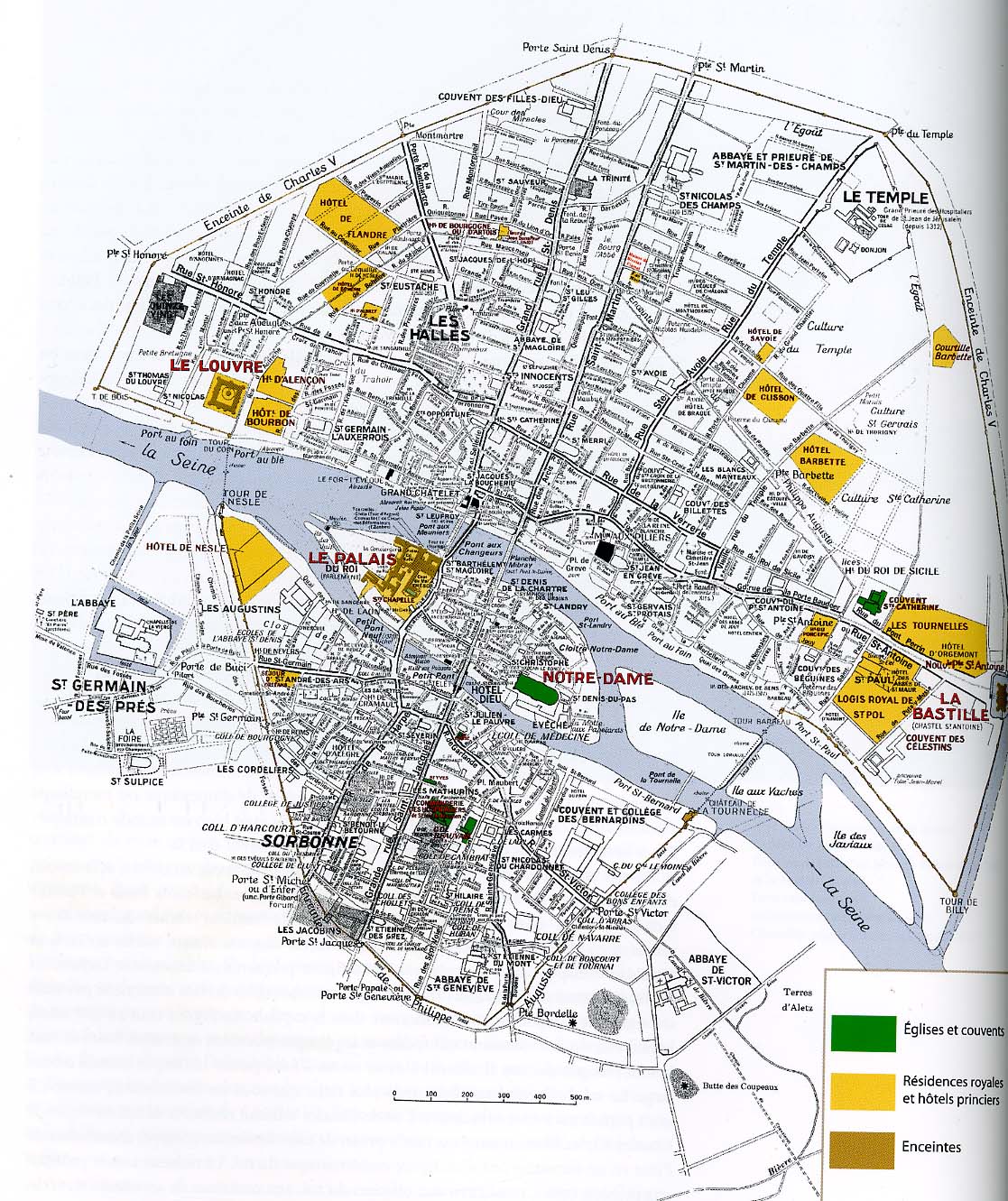
The plan of medieval Paris about 1380 created at the Laboratoire de Cartographie Thématique, by Jacqueline Leuridan and Jacques-Albert Mallet. Published in Paris 1400 , fig. 2.

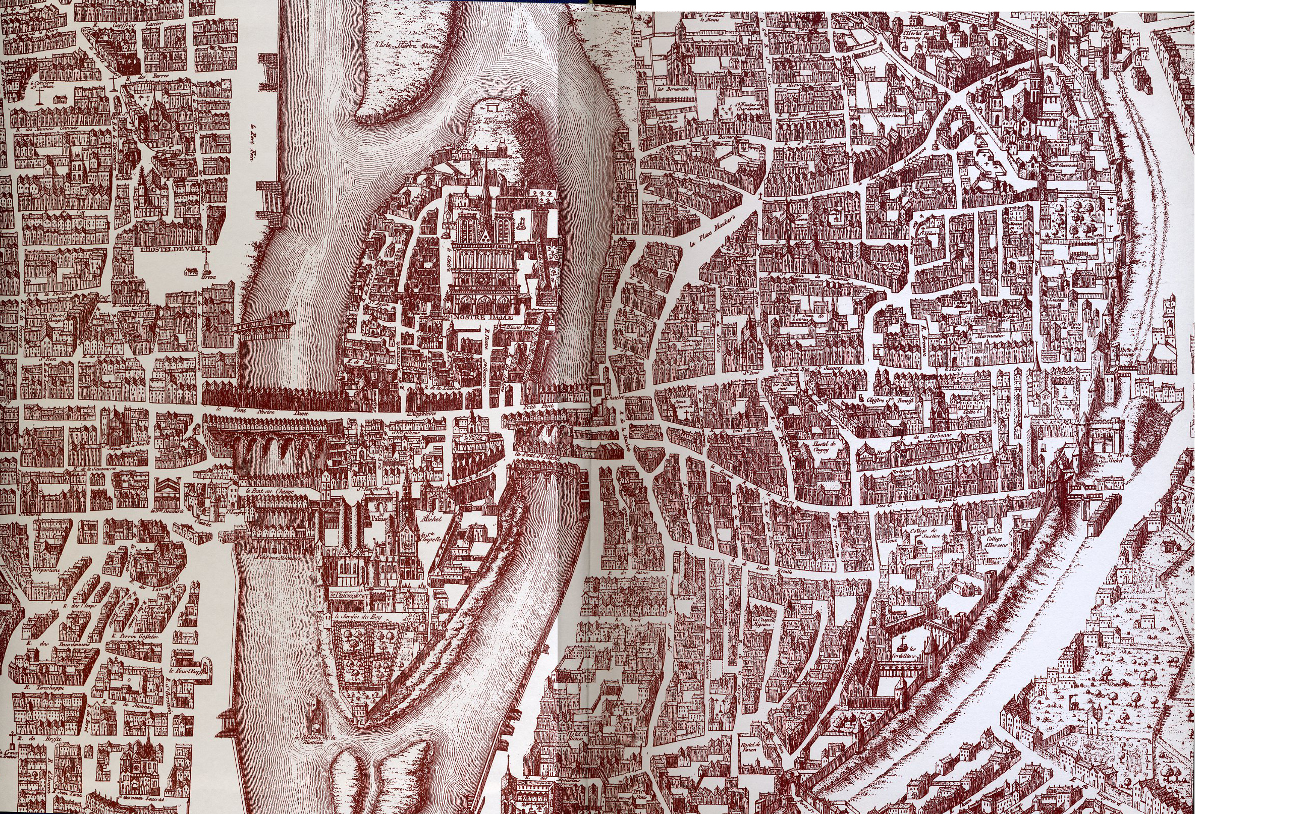
Detail of an engraved map by Dheulland dated 1756, a copy of an earlier engraving of a tapestry then in the Hotel de Ville in Paris, that depicted the city as it was under the reigns of Charles V and Charles VI.

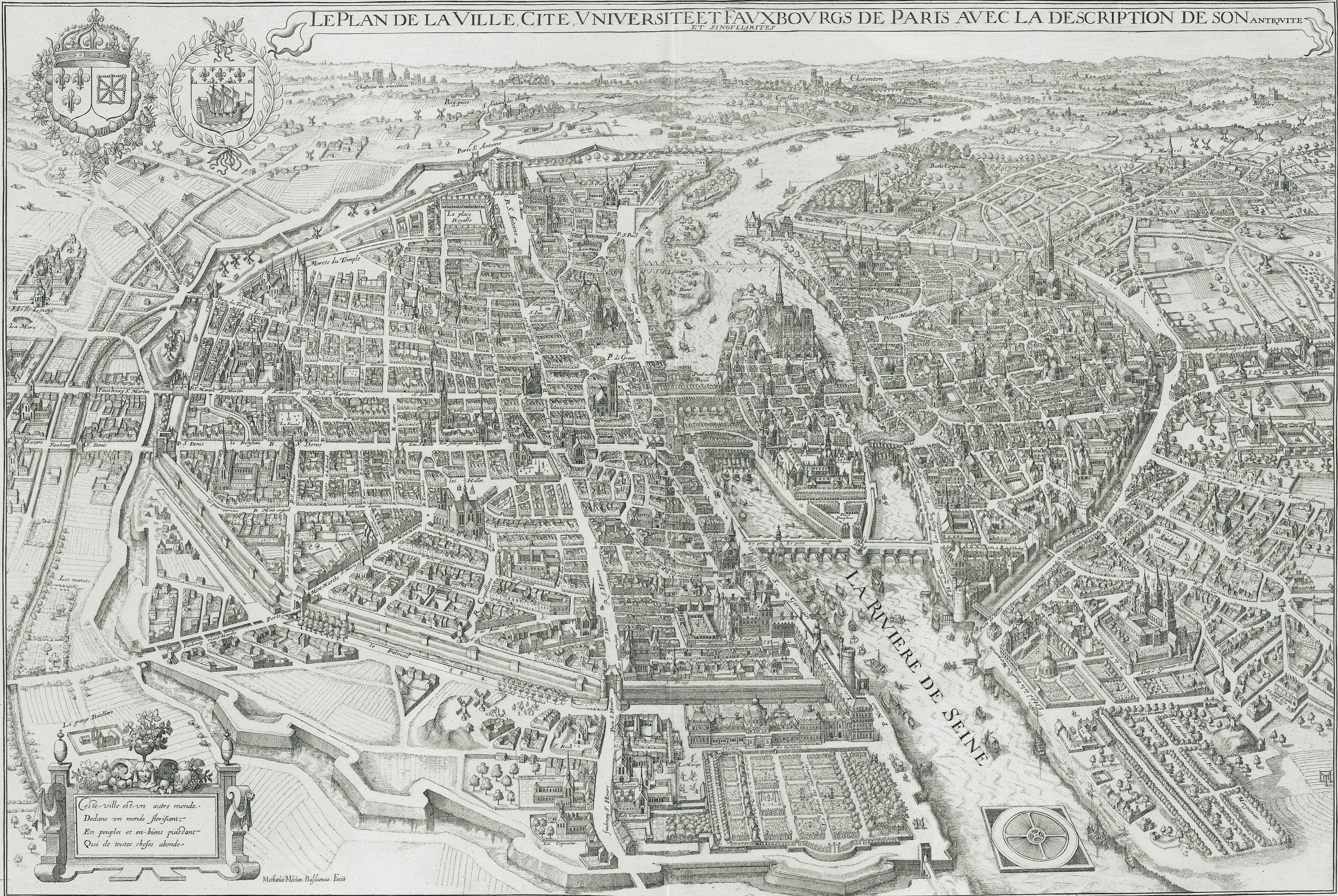
Map of Paris by Matthäus Merian in 1615.
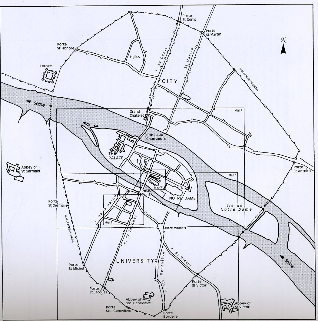
Rouse, Map 1: Map of Paris, c. 1200 with the wall of Philip Augustus.

Rouse, Map 2: Ile-de-la-Cité and Neighbourhood of St-Séverin.
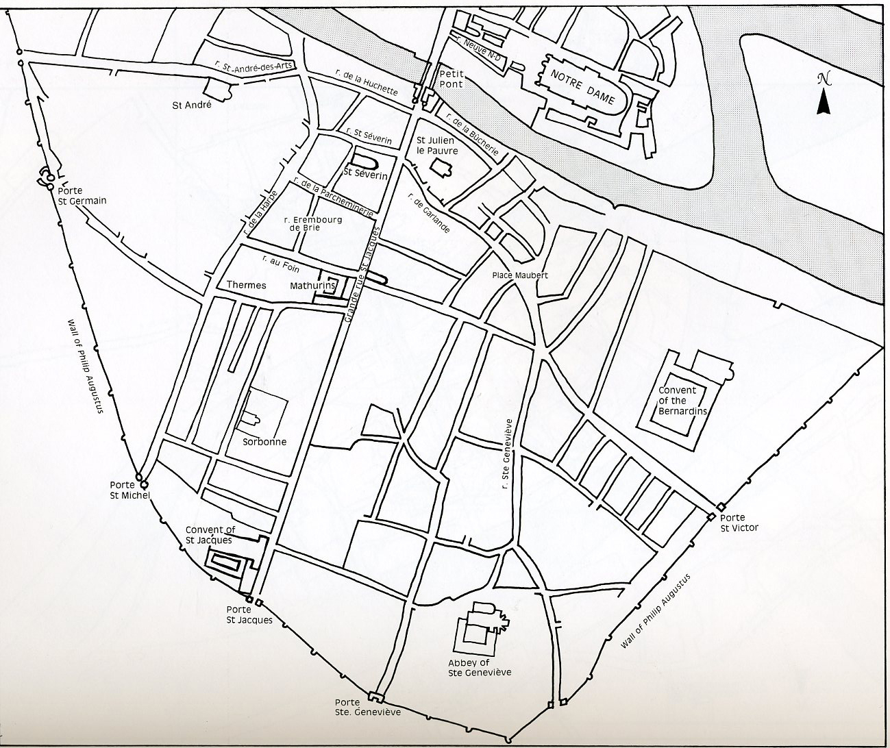
Rouse, Map 3: Left Bank
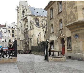
View of St. Severin at the intersection of Rue de la Parcheminerie (or Rue des escrivains) and the Rue Erembourg de Brie
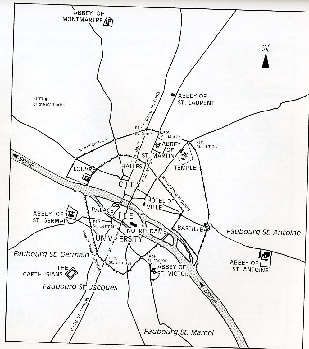
Rouse, Map 4: The Faubourgs in Medieval Paris
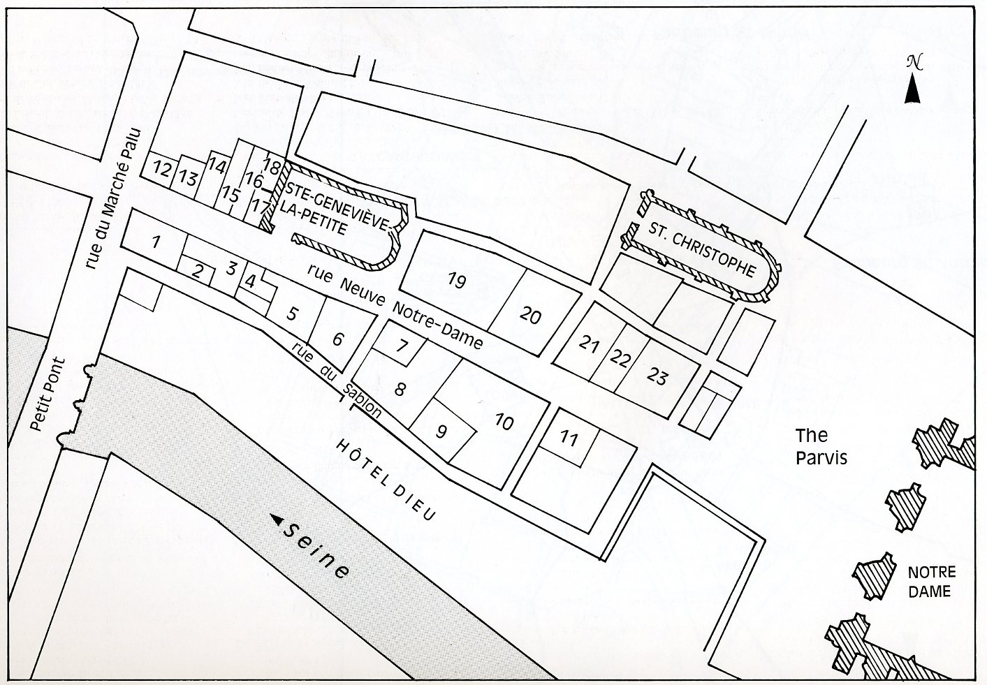
Rouse, Map 5: Houses on the rue Neuve Notre-Dame
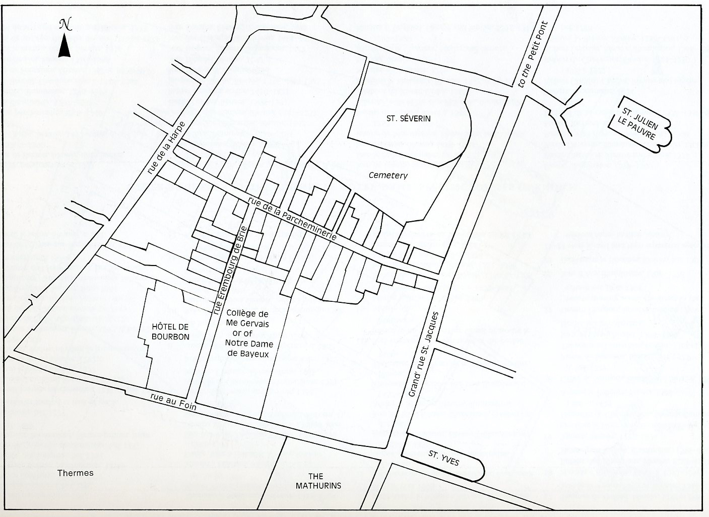
Rouse, Map 6: Houses on the rue Erembourg de Brie and the rue de la Parcheminerie
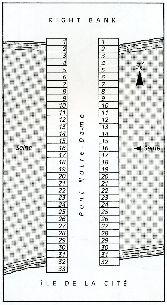
Rouse, Map 8: Houses on the Pont Notre-Dame

Professions on the Pont Notre Dame in 1455-56.