Field Research in the Mid-Atlantic
Piedmont, 2005-2007
This page is a photo journal of my research into soil
transporting processes in the forested hillslopes of NW Delaware and NE
Maryland. I have been ably assisted by undergraduates in the Environmental
Science program and the Ag School at the
Here’s a summary of my work with tree throw profiles and
soil transport in a poster I presented at the annual AGU meeting in San
Francisco, 2006:
AGU Fall 2006 Poster
(6.5 mb, pdf): Pits, Mounds, and Soil Transport on Hillslopes in NW Delaware.
The bottom line: I think I have established a proof of concept in getting at soil transport rates on hillslopes using the decay of pits and mounds left by tree throws. This would facilitate estimates of longer term fluxes of sediment from hillslopes, and hence could play a role in establishing a sediment budget for local drainage basins.
Below you will find a photo record of observations and research into
soil transport on hillslopes in the Piedmont of northwest Delaware…
|
|
Steve Sciscione lends a scale to this section of regolith
and soil overlying bedrock in a cutbank of a tributary to |
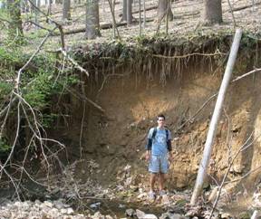
 this
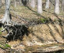
area is <2 m thick. At right a stream cutbank exposes bedrock and soil.
This is typical of the soil mantled landscape in the
this
area is <2 m thick. At right a stream cutbank exposes bedrock and soil.
This is typical of the soil mantled landscape in the |
|
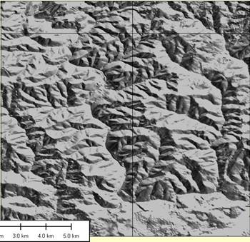
Gray scale shaded relief map of the Coastal Plain/Piedmont boundary |


|
|
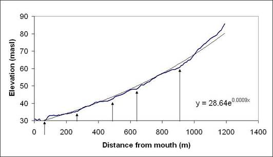
At left is a typical stream profile in the |
|
|
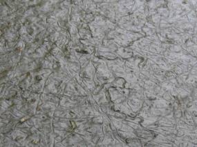
Below, earth worm castings dominate this O soil horizon.
In |
 At
left, earth worms leave trails in a drying mud puddle. Clearly, there’s a lot
of them in this area, and they could be the dominant soil transporter in many
cases!
At
left, earth worms leave trails in a drying mud puddle. Clearly, there’s a lot
of them in this area, and they could be the dominant soil transporter in many
cases!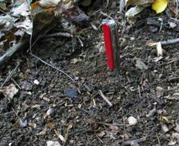 many
places, the annual thickness of castings can exceed 2 cm. Earth worm
activity, however, is not uniform across a forested landscape.
many
places, the annual thickness of castings can exceed 2 cm. Earth worm
activity, however, is not uniform across a forested landscape.|
|
Frost needles: a highly effective mechanism for eroding a stream cutbank in winter. Ice needles lift soil at a right angle to the ground surface. Upon melting, the soil particles fall according to gravity, often into the creek below, which then carries the sediment away… |
|
|
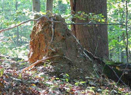
At left is a moderately recent tree throw (last 10-20 years??). The mound exhibits a nearly vertical face, so one mechanism of transport off the mound is likely to be slope collapse/failure. Mounds often exhibit rock-capped pinnacles—a clear sign of rain splash and surface runoff erosion. The log shows some signs of age—moss is growing, and bark is missing. I have set up a relative age system for describing log decay: Stage 0—Leaves still on; fell this year Stage 1—No leaves; bark is still solid; small rootlets and branches still present Stage 2—Bark is missing; log is still solid Stage 3—Log is >50% solid Stage 4—Log is < 50% solid Stage 5—Log is covered with decayed wood Stage 6—Log is a mound of duff Stage 7—Log is missing Now we need absolute time for this series… |
|
|
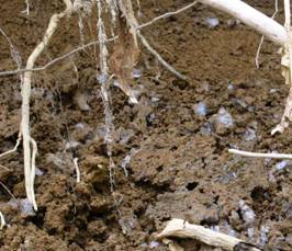
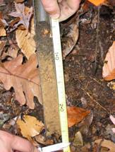
John Doroba, a former undergraduate Environmental Science
major at University of Delaware, exhibits style and balance in taking a core
from this tree growing on an old mound. To get at soil transport rates or erosion
rates, one needs to establish time and age. For tree throws, one might be
able to use a decay rate for logs. This has not yet been done for trees in |
|
|
|
 John
Doroba mapped soil profiles up and down slope from tree throw pits and
mounds. Here is a typical profile upslope with O, A, and B Horizons.
John
Doroba mapped soil profiles up and down slope from tree throw pits and
mounds. Here is a typical profile upslope with O, A, and B Horizons. 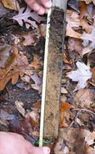 Soil
profile downslope from a tree throw mound; Here, we see O, A, B, then O/A,
then B. This is typical of soil transported downslope from the tree throw.
Soil
profile downslope from a tree throw mound; Here, we see O, A, B, then O/A,
then B. This is typical of soil transported downslope from the tree throw.|
|
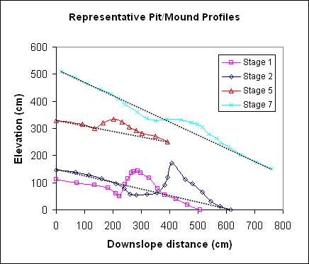
At left are typical profiles of pits-and-mounds, plotted against qualitative estimates of log decay (Stage 1 is solid log with bark on; Stage 6 log is duff; Stage 7 has no log). The dashed lines represent the pre-throw hillslope profile. Clearly, the mounds are evolving, which implies a non-zero sediment transport rate. |
|
|
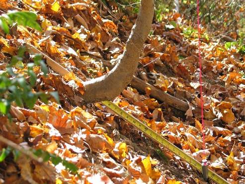
Curved tree trunks are usually signs of soil transport
around the growing tree. The tree, perhaps rooted into soil below the
creeping surface layer, experiences a rotation, and tries to grow up into the
light. Curved trunks are not that common in the |
Page set up and maintained by Les Hasbargen:
lesh@udel.edu
Last modified December 25, 2007
Les currently teaches in the
Earth Sciences Dept., SUNY Oneonta
Les is solely responsible for
the content on this page.