|
|
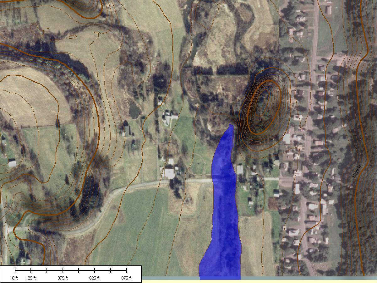
Mt. Vision, New York |
|
Back to 2006 Flood Introduction SUNY Oneonta home Otsego County’s June 2006 Flood
Data, with flooded areas for the main valleys, road closures, etc. Dartmouth’s
flood map for the 2006 flood |
Map of Mt. Vision, New York,
flooded to 1160 feet above sea level. Based on the photos, water was about 1
½ feet to the top of the bridge over Otego Creek on County Highway 11B, Mill
Street (the open circle). Contour interval is 5 feet. North is up. Air photo
is from National Aerial Imagery Program, 2005-2006. Topography is from USGS
1/3 arc second elevation data. |
|
Data source for flood height: Ground-based photos
of County Highway 11B across Otego Creek at Mt. Vision, taken by Anita Briggs
of the Daily Star, in Flood 2006:
Disaster in the Heartland of New York, by the Daily Star. |
|
|
Page maintained by Les Hasbargen:
hasbarle@oneonta.edu |
|
