METR
360
Fall,
2018
Final
Exam
Directions: Answer all parts of
all 5 questions in the blue books or write a text file which you e-mail to Jerome.Blechman@oneonta.edu. For calculations, show all work. You may use any
source, including your notes, any textbook or the Internet. You may NOT
talk during the exam, except to your professor. Raise your hand if you have a
question.
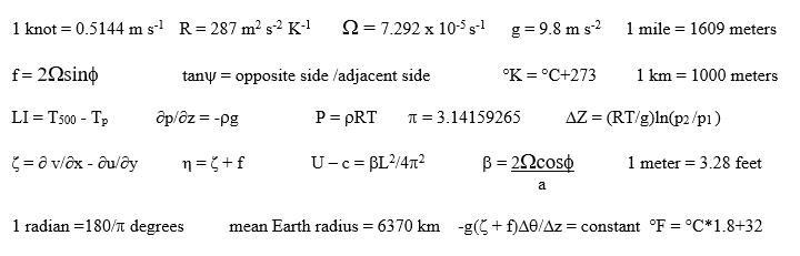
The following information may (or may
not) be useful:
1. On the paper map of station weather plots, draw the following
in the correct places:
a. ( 6%) The 1008, 1012, and 1016 mb isobars.
b. ( 8%) Highs (H), Lows (L), and any fronts that these data require. Use
the proper symbols and colors.
2. For this question you have a number of PowerPoint loops at your disposal. Some may be useful but probably some aren’t useful. You must use the appropriate loops to answer the questions. In particular, you have NAM loops of the MSLP/1000-500 mb Thickness, MSLP/temperature, 850 mb, 700 mb, 500 mb, and 250 mb. Assume these are perfect forecasts.
a.
( 5%) The MSLP forecasts show a cyclone that first appears in Wyoming at 06Z on
11/24 and this is the cyclone that develops and intensifies. Why does the
surface cyclone start in Wyoming rather than Colorado and why does it intensify
after 06Z? This requires an explanation.
b. ( 6%) Oneonta, NY (KNYO) is marked on a base map for you. The trough reaches Oneonta after traveling 2712 miles in 84 hours so the wave traveled at 32 miles/hour or 14.4 m s-1. Using the Rossby Wave Equation, what is the mean west-east wind speed in the U.S. during this forecast period? Estimate anything you don’t already have from the maps (except the mean west-east wind speed) and show your work completely. Express your answer in m s-1.
c.
( 3%) At 18Z Sunday, 11/25/18, there are two jet streams in the central U.S.
What is the wind speed in the Jet Streak of the Subtropical Jet?
e.
( 8%) The same base map also shows one of our WxChallenge
stations, Omaha, Nebraska (KOMA). Produce a WxChallenge
forecast for KOMA for the period from 06Z 11/25/18 to 06Z 11/26 18, based
only on the guidance shown on the NAM forecast maps. You must, as
always, forecast the maximum temperature in °F, minimum
temperature in °F, maximum 2-minute wind speed in kts,
and total precipitation in inches and hundredths.
3. You have a paper copy of a plotted but not analyzed 500 mb map.
a. ( 12%) On the paper map, draw the 30, 50, and 70 knot isotachs only. Draw them in pencil, then ink over in black. Label them wherever they need labels.
b. (4%) Based on your analysis from part a, label all the Jet Streaks with a blue capital J.
c. ( 8%) Pick one of your Jet Streaks from part b. In the appropriate places for that Jet Streak only, label the ageostrophic motion quadrants with the standard meteorological names.
d. ( 4%) For each quadrant, label each with a + for upward vertical motion and a – for downward vertical motion. Make these symbols large, please.
4. For this question you are to use text guidance to answer questions for Roanoke, VA. It’s location is marked as KROA on the base map you used in question 1. The dates are generic, i.e., Day 1, Day 2, but this was a real situation. You have a combined NAM and GFS MOS, the NAM direct model output, and the GFS direct model output.
a. ( 4%) The important parts of this forecast for Roanoke are the precipitation type and amount. How much total liquid equivalent precipitation is forecast to fall on KROA by the NAM from Day 1 through Day 3? How much total liquid equivalent precipitation is forecast to fall on KROA by the GFS from Day 1 through Day 3? Use the correct units.
b. ( 6%) What type(s) of precipitation will fall at KROA, according to both the NAM and GFS guidance? Briefly explain your reasoning.
c. ( 5%) On the NAM direct output, there is a number 260 at 2/18 for the line marked 500 mb. The same spot on the GFS direct model output shows 48. These numbers are very different. What do they actually mean and how does that difference help explain the different answers for NAM and GFS that you got for total liquid equivalent precipitation at KROA?
d. ( 5%) Is there a front that is associated with the forecast precipitation during this period at KROA? If so, what kind of front is it? Briefly justify your answer, using information from the guidance.
5. Examine a sounding for an unnamed (but real) U.S. station.
a. ( 3%) Find a layer that is absolutely unstable and report it using the top and bottom pressures (for example, you might say 500-450 mb).
b. ( 5%) The layer you found for part a should be absolutely unstable but any upward vertical motion caused by the instability will be shallow, that is, the air won’t go very high in the atmosphere. Explain why, using the sounding.
c. ( 4%) Where is the tropopause? Briefly explain how you know it is there.
d. ( 4%) Look at the reported winds. What two important characteristics of the wind profile do you NOT see on this sounding above 900 mb?