|
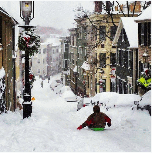
January 2015 Boston
Blizzard |
From NWS-BOS, picture by Sarah Levy |
http://weather.rap.ucar.edu/upper/ |

METR 360
Fall,
2015
"Profession"
by Issac Asimov (web link to abelard.org)
Lab workbook (pdf
-
requires Adobe
Reader)
Sample Exams (these are the exams given last year)
Lecture Topics
|
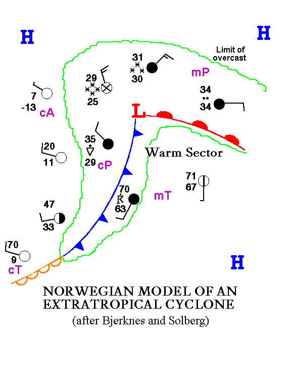
Norwegian Cyclone Model Review |
|
|
(following Bjerknes
and Solberg) |
|
|
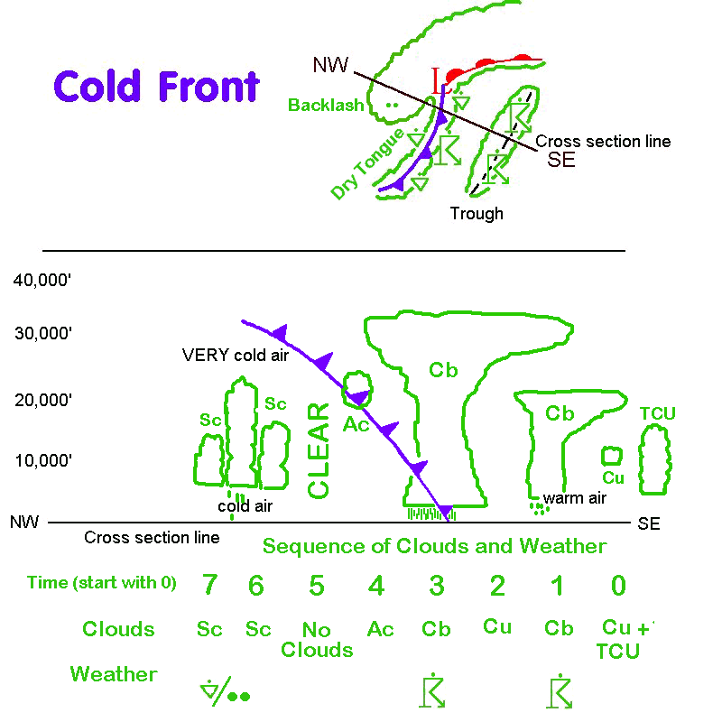
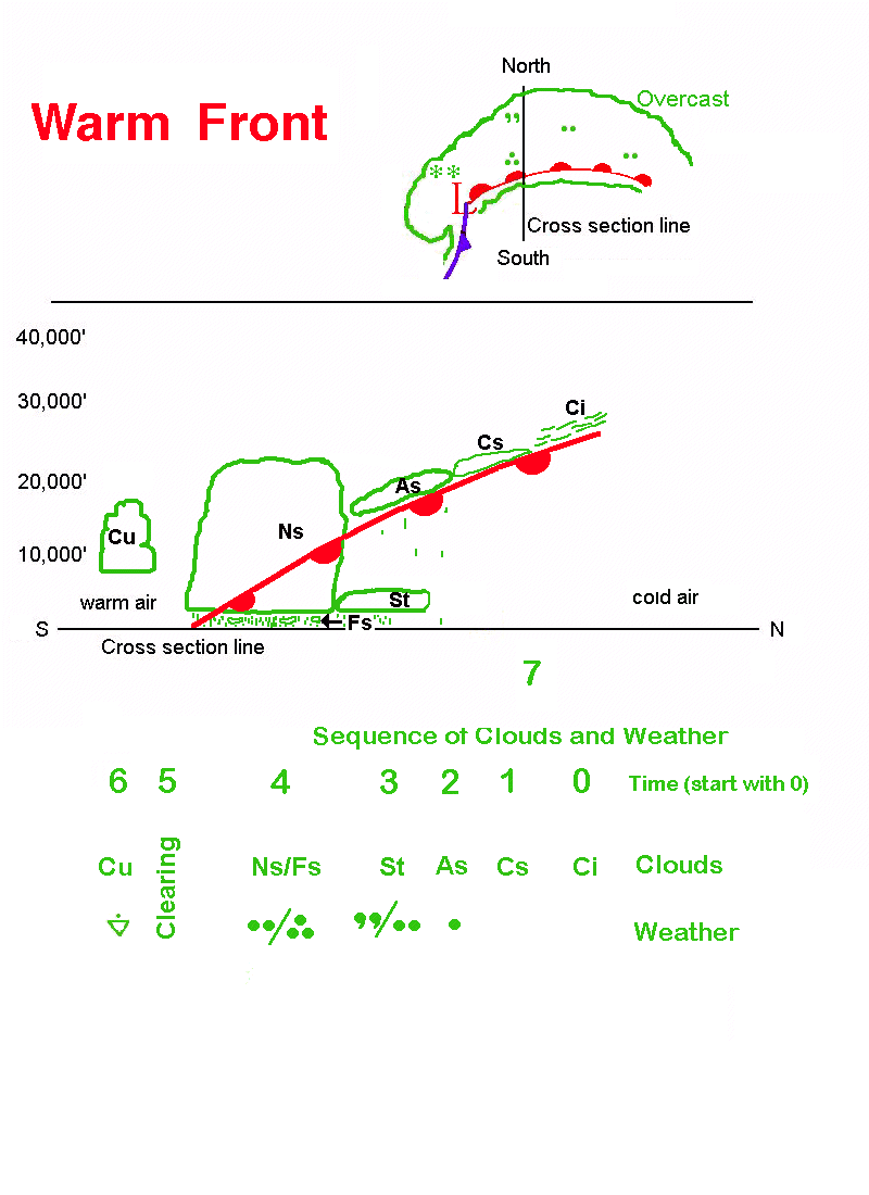
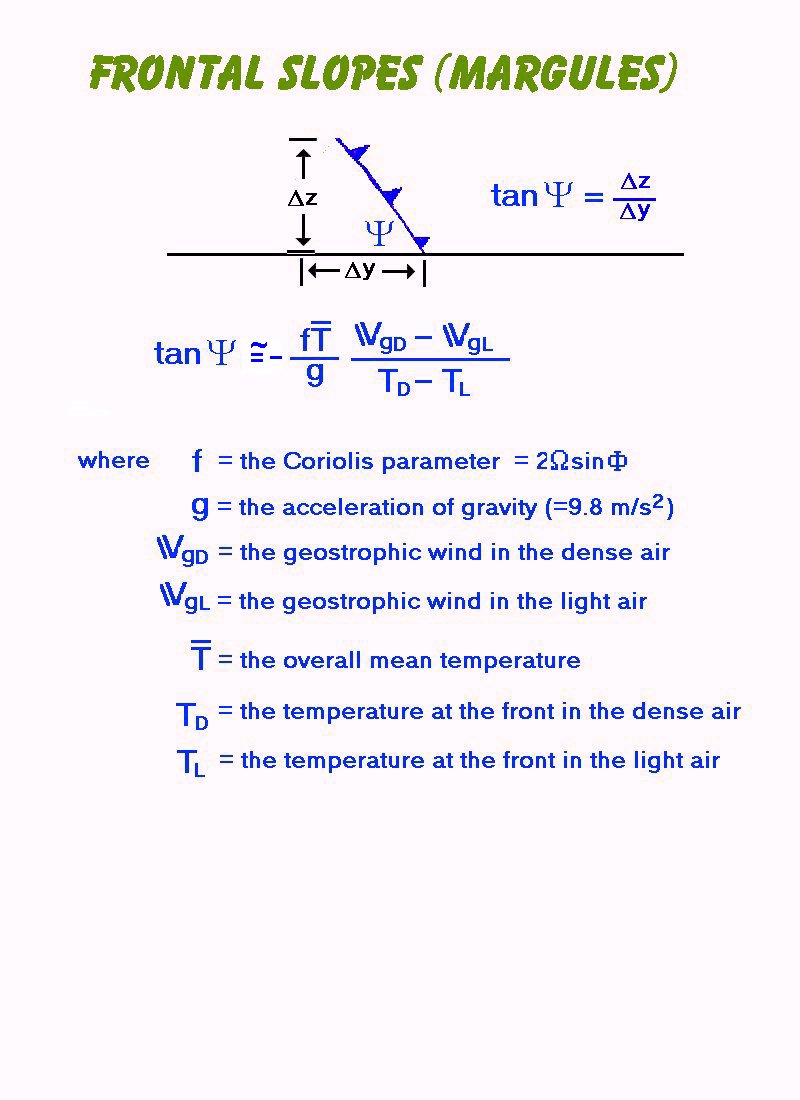
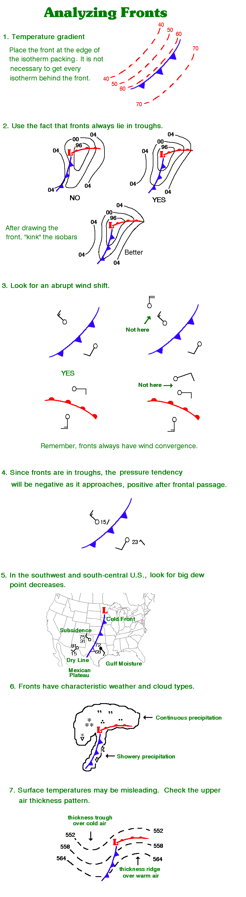
Fronts |
|
|
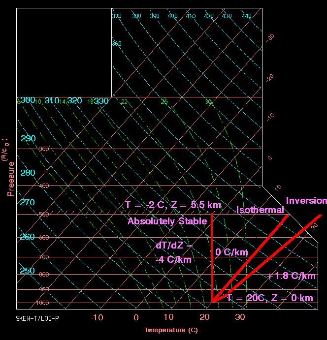
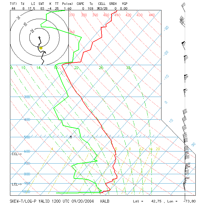
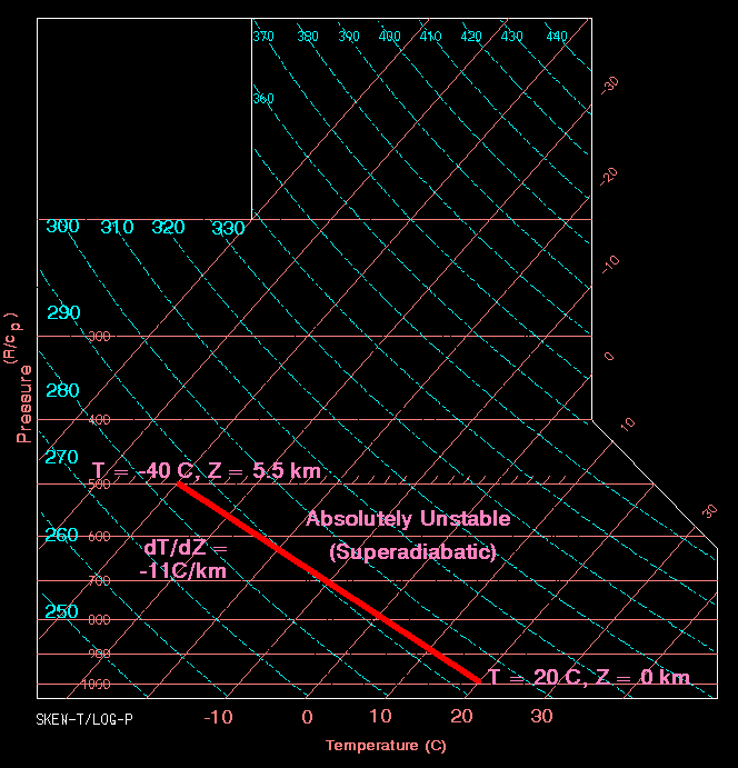
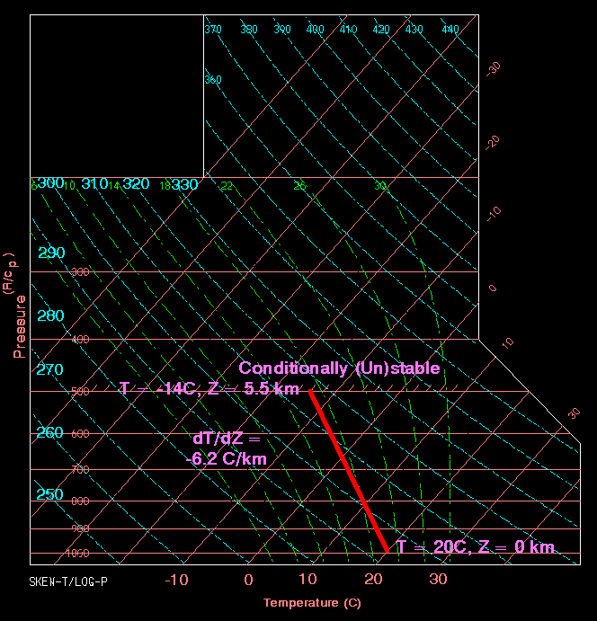
Stability |
||
|
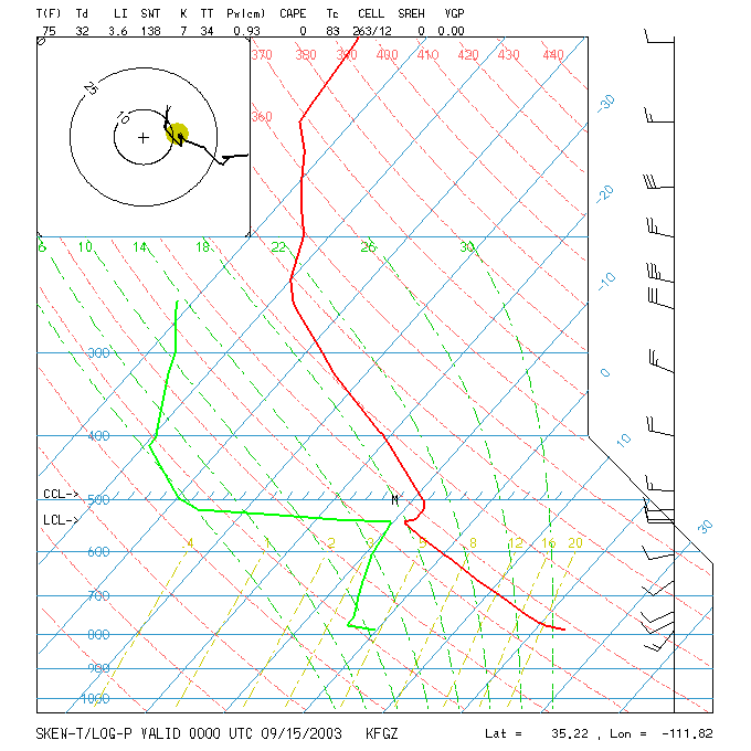
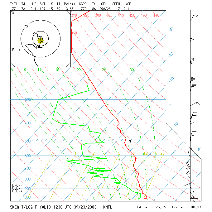
Sample skew-T log-P diagrams: |
Examples (from NCAR-RAP): |
|
|
Upper Air |
|
Guidance |
|
|
Waves in the Westerlies
(Rossby waves) |
|
|
Here are some places to view hemispheric upper air maps and
see the waves: |
|
|
Univ. Wyoming
(choose Northern Hemisphere and uncheck Observations box) |
|
|
Vertical Motion |
|
Potential Vorticity (cyclogenesis) |
|||
|
Jet Streams |
Click to go to the Meteorology Club home page